If you are searching for Waze symbols, you probably want a simple answer to one question: What does that icon on my Waze map mean?
Waze uses symbols, colors, markers, and alerts to show traffic, crashes, police reports, hazards, cameras, road closures, construction, weather conditions, railroad crossings, other Wazers, and navigation information. The important part is knowing that not every symbol is a warning. Some icons describe something happening on the road, while others identify a permanent map feature, your destination, your vehicle, or another Waze user.
This guide explains the most common Waze icons and map symbols, what they mean, how to tell different categories apart, why some symbols may not appear, how traffic colors work, and how to customize the alerts you see.
Waze’s current alert system includes categories such as cameras, road features, police, crashes, traffic, hazards, cars on the shoulder, bad weather, blocked lanes, construction, closures, and other reports. The exact alerts available can vary by location.
Quick Answer: What Do Waze Symbols Mean?
Waze symbols are visual indicators that communicate navigation information, traffic conditions, road incidents, mapped road features, camera locations, or information about other Waze users.
The most common categories include:
| Waze symbol or map element | What it usually means | Type |
| Traffic color | Slow or congested traffic | Traffic condition |
| Police icon | Reported police presence | User/road report |
| Crash icon | Reported accident or crash | Incident report |
| Hazard icon | Reported danger or obstruction | Incident report |
| Construction icon | Roadwork or construction | Road report |
| Camera icon | Mapped traffic or enforcement camera | Map feature |
| Closure indicator | Road or section is closed | Road condition |
| Blocked-lane alert | Lane obstruction | Road report |
| Car-on-shoulder alert | Vehicle stopped on shoulder | Road report |
| Weather alert | Weather-related driving hazard | Road report |
| Railroad crossing symbol | Railroad crossing | Map feature |
| Traffic-light symbol | Mapped traffic signal | Map feature |
| Road shield | Highway or route identification | Navigation/map feature |
| Car icon | Your vehicle marker | Navigation |
| Destination marker | Your selected destination | Navigation |
| Wazer or mood icon | Another Waze user | Community feature |
The key distinction is simple:
Icons tell you what something is. Road colors often tell you how traffic is moving. Navigation markers tell you where you are going.
What Are Waze Symbols?
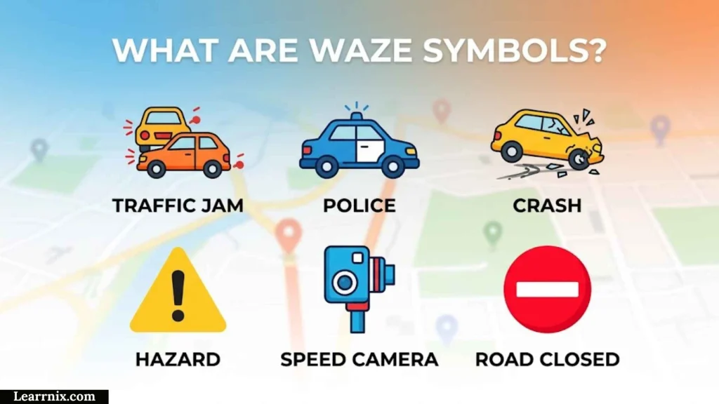
Waze symbols are graphical indicators displayed on the Waze map to help drivers understand what is happening around them.
Unlike a traditional paper map, Waze combines several information sources into one live navigation interface.
A symbol may represent:
- A temporary traffic incident
- A user-submitted report
- A mapped road feature
- A traffic or enforcement camera
- A road closure
- A weather condition
- Your current position
- Your destination
- Another Waze user
- A route or road number
This distinction matters because seeing an icon does not automatically mean something is wrong.
For example, a railroad crossing symbol identifies a physical road feature. A crash icon represents an incident report. A red road indicates significant traffic rather than automatically meaning that the road is closed.
The Four Main Types of Waze Symbols
The easiest way to understand the Waze map is to divide its symbols into four groups.
1. Incident and Report Symbols
These tell you about something happening on or near the road.
Examples include:
- Police
- Crash
- Traffic
- Hazard
- Construction
- Blocked lane
- Car on shoulder
- Bad weather
- Road closure
Many of these reports can come from Waze users or other data sources. Waze’s official documentation lists numerous report categories and allows users to control whether selected alerts appear on the map or generate driving alerts.
2. Permanent or Mapped Road Features
These describe the road itself rather than necessarily reporting a temporary problem.
Examples include:
- Railroad crossings
- Traffic lights
- Road features
- Route numbers
- Camera locations
A mapped feature can remain on the map even when there is no immediate incident.
3. Navigation Symbols
These help you understand your own trip.
Examples include:
- Your vehicle
- Your route
- Your destination
- Road shields
- Navigation arrows
These symbols answer questions such as Where am I?, Where am I going?, and Which road am I using?
4. Waze Community Symbols
These relate to the Waze community.
Examples include:
- Other Wazers
- User moods
- Special driving experience icons
Waze allows users to choose moods that can be displayed to nearby Wazers, while the selected car icon is visible only to the person using it.
Waze Traffic Symbols and Road Colors
Traffic information is one of the most important parts of the Waze map.
Instead of relying only on a small traffic icon, Waze can use road colors to communicate how traffic is moving.
Waze’s Traffic View documentation describes these traffic states as:
- Green: Drivers are moving at or near the speed limit
- Yellow: Light traffic
- Light red: Moderate traffic
- Red: Heavy traffic
- Dark red: Bumper-to-bumper or near-standstill traffic
What Does a Red Road Mean on Waze?
A red road generally indicates heavy traffic and significant congestion.
It does not automatically mean:
- The road is closed
- There has been a crash
- Police are present
- The road is dangerous
A red road describes the traffic condition. An additional crash or hazard icon may explain why the road is congested.
What Does Dark Red Mean on Waze?
Dark red represents an even more severe traffic condition.
Waze describes dark red traffic as bumper-to-bumper traffic at a near standstill in its traffic visualization system.
If you see a dark-red section ahead, expect a substantial slowdown and allow extra travel time.
What Does Yellow Mean on Waze?
Yellow indicates lighter congestion.
Traffic is slower than ideal, but vehicles can generally continue moving.
For example, a city road during the afternoon commute might turn yellow before becoming red as congestion increases.
What Does Green Mean on Waze?
Green represents relatively normal traffic conditions.
In Waze’s traffic visualization documentation, green means drivers are moving at the speed limit.
A green road does not guarantee that there are no hazards. It primarily tells you about the traffic flow.
Waze Police Symbol
The police symbol indicates a police-related report.
Waze currently lets users report police sightings and, in supported countries, choose more specific categories such as:
- Police
- Mobile camera
- Hidden
- Other side
The exact options may vary by country.
What Should You Do When You See the Police Symbol?
Treat the icon as advance information, not as a guarantee that a police vehicle is still at the exact location.
A report can become outdated as traffic conditions change.
The correct response is not to change your driving behavior because of the report. Instead:
- Continue following the applicable speed limit.
- Watch the road carefully.
- Follow traffic signs and signals.
- Follow instructions from law enforcement.
- Avoid interacting with your phone while driving.
Why Can a Police Report Disappear?
Waze reports can change as conditions change.
A police officer may leave, the reported situation may no longer be relevant, or Waze may stop displaying the report.
This is one reason not to treat a Waze report as a permanent map feature.
Waze Crash Symbol
The crash symbol indicates a reported accident or collision.
A crash can affect more than the location where the vehicles are stopped. It may cause:
- Traffic congestion
- Blocked lanes
- Emergency vehicle activity
- Debris
- Sudden braking
- Temporary road restrictions
Waze also has a separate crash-history alert system that can warn drivers about road segments with a history of crashes. Those alerts are dynamic and can consider current traffic, road conditions, time of day, and recent crash reports.
Real-World Example: Crash Plus Red Traffic
Suppose Waze shows a crash icon 2 kilometers ahead and the road leading to it is red.
Those two indicators provide different information:
- Crash icon: A reported incident exists.
- Red road: Traffic is heavily congested.
Together, they suggest that the crash is having a noticeable effect on traffic.
That is more useful than treating the two symbols as duplicates.
Waze Hazard Symbols
Hazard symbols warn about potentially dangerous or unusual conditions.
Waze’s alert categories include hazards, car-on-shoulder reports, other hazards, bad weather, and blocked lanes.
A hazard can include situations such as:
- Debris
- An object on the road
- A dangerous obstruction
- A stopped vehicle
- Flooding
- Snow or severe weather
- A blocked lane
Road Hazard Symbol
A road-hazard symbol indicates that something may require extra attention.
The important point is that hazard does not always mean accident.
A driver may report a dangerous object or road condition even when no crash has occurred.
For example, a fallen object in a lane could create a serious risk without causing an accident yet.
Car on Shoulder Symbol
A car-on-shoulder alert warns that a vehicle has been reported stopped on the roadside.
This matters particularly on:
- High-speed highways
- Narrow shoulders
- Curved roads
- Poorly lit roads
- Heavy-traffic routes
When approaching a reported stopped vehicle, stay alert and avoid sudden lane changes.
Blocked Lane Symbol
A blocked-lane report means that traffic may not be able to use a particular lane normally.
Possible causes include:
- A collision
- Road debris
- Construction
- A disabled vehicle
- Emergency activity
The safest response is to merge only when it is legal and safe rather than waiting until the last moment.
Waze Construction Symbol
A construction or roadwork symbol indicates roadwork or construction activity.
Construction can create:
- Lane closures
- Reduced speed
- Temporary traffic patterns
- Detours
- Barriers
- Workers near traffic
Construction information is especially useful because a road can be technically open while still being significantly slower than normal.
Why Construction Can Change Your Route
If construction causes a major slowdown or closure, Waze may consider the resulting traffic conditions when calculating routes.
This is different from a permanent road feature because construction conditions can change over time.
A road that is open in the morning may have a lane closure later in the day.
Waze Camera Symbols
Camera symbols identify mapped cameras.
Waze’s current camera documentation identifies several camera types, including:
- Speed camera
- Red-light camera
- Speed and red-light camera
- Stop-sign camera
- Mobile police camera
Waze says camera locations are added using reports from partners and map editors. If a camera has not been reported through those sources, Waze may not know about it.
Speed Camera Symbol
A speed-camera symbol indicates a mapped camera that records vehicle speed at a specific location.
Use the alert as a reminder to follow the posted speed limit.
It should never be treated as permission to speed when no camera symbol is present.
Red-Light Camera Symbol
A red-light camera symbol indicates a camera associated with vehicles entering an intersection against a red signal.
Some red-light cameras can also record speeding, according to Waze’s current camera documentation.
Speed and Red-Light Camera Symbol
Some cameras can monitor both vehicle speed and red-light violations.
Waze identifies this as a separate camera category.
Stop-Sign Camera Symbol
This type of camera records vehicles that fail to stop at a stop sign.
The correct response is simple: obey the actual stop sign regardless of whether Waze displays an icon.
Mobile Police Camera Symbol
Waze also identifies mobile police cameras as a camera category. These can be associated with police units that record vehicle speed.
Are Waze Camera Symbols Always Accurate?
No navigation app can guarantee that its map contains every camera.
Waze explicitly notes that if a camera has not been reported by an editor or partner, it may not know about it.
That makes camera icons useful for awareness, but not a replacement for obeying speed limits, signals, or road signs.
Waze Road Closure Symbol
A road closure indicates that a road or road segment is unavailable.
Closures may result from:
- Construction
- Accidents
- Flooding
- Special events
- Emergency activity
- Other temporary restrictions
A closure is fundamentally different from heavy traffic.
Traffic means the road is being used but movement is slow.
Closure means the road cannot normally be used.
Why Does Waze Reroute Around a Closed Road?
When Waze has information indicating that a road is closed, that information can affect route planning.
For example, imagine your normal route uses a bridge. If that bridge is closed, Waze may need to calculate a completely different path rather than simply warning you about congestion.
However, temporary road conditions can change faster than digital map information. Always follow physical barricades, signs, police instructions, and other real-world controls.
Waze Railroad Crossing Symbol
An X-shaped symbol on the Waze map can represent a railroad crossing.
A Waze Community product expert specifically identifies the X-shaped map symbols as railroad crossings.
This is an important example of why not every Waze icon is a user-submitted warning.
A railroad crossing is a mapped road feature.
What Should You Do at a Railroad Crossing?
The Waze symbol is only an advance indication.
When you reach the crossing:
- Follow the crossing lights.
- Stop when required.
- Obey gates and warning signals.
- Never drive around a lowered gate.
- Watch for trains in both directions.
The physical crossing controls always take priority over the app.
Waze Traffic-Light and Road-Feature Symbols
Waze can also display mapped road features.
These may include traffic lights and other features associated with the road network.
This information is different from a temporary user report.
For example:
Traffic-light symbol: A mapped feature of the road.
Crash symbol: A reported incident.
That difference helps explain why some icons remain on the map while others disappear.
Waze Weather Symbols
Weather-related symbols can warn about driving conditions associated with weather.
Waze’s current alert categories include bad weather, while its partner documentation also identifies hazards such as heavy snow and flooding.
Possible weather-related driving problems include:
- Flooding
- Snow
- Ice
- Heavy rain
- Poor visibility
- Other dangerous conditions
Why Weather Alerts Matter Even When Traffic Is Green
A road can have little congestion and still be dangerous.
For example, a flooded road may show relatively little traffic because drivers are avoiding it. The lack of a red traffic line does not mean the road is safe.
Traffic information and hazard information answer different questions.
Waze Wazer Symbols and Little People
If you see small characters, avatars, or mood icons on the Waze map, they may represent other Wazers.
Waze allows users to select a mood that can be displayed to other Wazers nearby.
These symbols are primarily community features.
What Do the Little Characters on Waze Mean?
They generally represent other Waze users or their selected moods.
They do not necessarily indicate:
- Traffic
- Police
- A crash
- A road closure
- A hazard
That is why seeing several little characters on a road does not mean that road is experiencing several incidents.
Can You Change Your Waze Mood?
Yes.
Waze’s current help documentation explains that users can open their profile, select Mood, and choose an available mood. The selected mood can be displayed to Wazers around you.
Availability can vary by region and special driving experience.
Waze Car Icon
Your car icon represents your own vehicle on the Waze map.
Waze allows users to choose a car icon through:
Settings → Map display → Car icon
The selected car icon is visible only to you.
Is the Waze Car Icon the Same as a Wazer Icon?
No.
Your car icon represents your own navigation position.
Other Wazers can appear separately as community icons or moods.
This distinction is useful when you are trying to determine whether an icon represents your location or another driver.
Waze Destination Symbol
The destination marker identifies the location you selected as your destination.
It is part of the navigation layer rather than an incident-report layer.
This means:
- Destination = where you are going
- Vehicle marker = where you are
- Route = how Waze plans to get you there
- Incident symbol = something reported or mapped along the way
Keeping these categories separate makes the Waze interface much easier to understand.
Waze Road Shields and Route Symbols
Road shields identify numbered roads, highways, or routes.
They answer a navigation question:
Which road am I traveling on?
They do not necessarily indicate:
- Traffic
- Police
- A crash
- Construction
- A closure
For example, a highway route number can appear alongside a red traffic section.
The road shield identifies the road. The red road identifies congestion.
Waze Symbols: Reports vs. Map Features
This is one of the most useful distinctions for beginners.
| Feature | Example | Temporary? | Main purpose |
| User report | Crash | Usually | Warn about an incident |
| User report | Police | Usually | Report police presence |
| User report | Hazard | Usually | Warn about danger |
| Traffic condition | Red road | Changes | Show congestion |
| Map feature | Railroad crossing | Usually permanent | Identify road feature |
| Map feature | Traffic light | Usually permanent | Identify road feature |
| Camera | Speed camera | Usually mapped | Identify camera |
| Navigation | Destination | Trip-based | Show destination |
| Navigation | Car icon | Trip-based | Show your position |
| Community | Wazer mood | Temporary | Show another user |
The practical lesson is:
A Waze icon can tell you what is there, what is happening, where you are going, or who else is using the app.
Why Some Waze Symbols Disappear
Waze is designed around changing road information.
A temporary report can disappear or stop being relevant because:
- The incident has ended.
- Traffic conditions changed.
- The report is no longer relevant.
- Waze no longer prioritizes it for your route.
- You moved away from the affected area.
- Your route changed.
Waze explicitly says it limits the number of alerts a driver sees on a route to reduce distraction and prioritizes alerts according to factors such as road familiarity and the relevance and type of alerts.
Why Doesn’t Waze Show Every Report?
Because showing every available report could overload the driver.
Waze says it limits and prioritizes alerts to reduce driver distraction. As a result, you may not receive an alert about everything that exists along your route.
This is important when interpreting an apparently empty map.
No icon does not necessarily mean no problem exists.
Why Waze Symbols Can Differ by Location
Waze does not necessarily provide exactly the same reports and features in every country.
Official Waze documentation notes that alerts may vary based on location.
Differences can result from:
- Local laws
- Available map data
- Community reporting
- Camera data
- Feature availability
- Regional app behavior
- Map editing
- Partner data
For this reason, a symbol described in an online guide may not appear exactly the same way on every device.
Why Waze Symbols Can Change After an App Update
Navigation apps evolve.
Waze can change:
- Icon designs
- Settings locations
- Alert categories
- Available camera types
- Special driving experiences
- Map presentation
- User interface elements
Therefore, a guide should focus on the meaning and category of a symbol, not only its exact shape or color.
If an icon looks slightly different after an update but belongs to the same report category, the underlying concept may still be the same.
How to Customize Waze Symbols and Alerts
Waze gives users control over many report categories.
According to current Waze Help instructions:
- Open Waze.
- Tap the menu.
- Open Settings.
- Select Alerts and reports.
- Tap Reports.
- Choose the alert category.
- Adjust Show on map and, where available, Alert while driving.
Available categories can include:
- Cameras
- Road features
- Police
- Crash
- Traffic
- Hazards
- Car on shoulder
- Bad weather
- Blocked lane
- Construction
- Closures
- Crash history
- High-risk areas
- Other reports
The exact list can vary by location.
Should You Turn Off Waze Symbols?
Usually, it is better to customize rather than disable everything.
If your map feels crowded, consider removing less useful visual information while keeping alerts that can affect safety or route decisions.
For example, a driver might prefer to keep:
- Crash alerts
- Hazards
- Blocked lanes
- Closures
- Bad weather
while reducing less important visual clutter.
The right settings depend on your driving environment.
How to Hide Wazer Mood Icons
Waze community guidance indicates that users can turn off the display of other Wazers through the map-display settings.
If social icons are making the map difficult to read, reducing those visual elements can make the navigation screen easier to understand.
The exact menu wording can change with app updates, so use the current Map Display settings on your device.
How Waze Reports Become Map Symbols
Waze is heavily dependent on information about current road conditions.
Drivers can report things they see on the road. Waze also receives information from other sources and its map-editing community.
For example, Waze’s current police-report instructions allow drivers to report police sightings directly through the app.
Its traffic-report system similarly allows drivers to report traffic and specify whether conditions are heavy or at a standstill.
Why Accurate Reports Matter
A report is most useful when it describes a real, current condition.
Waze advises users reporting police sightings to report only incidents they see in real time and as close as possible to the actual location.
That principle applies broadly to community-driven navigation:
Accurate reports help other drivers make better decisions.
Real-World Waze Symbol Scenarios
Understanding symbols is easier when several appear together.
Scenario 1: Red Road Plus Crash Icon
You are driving toward a city center.
Waze shows:
- Red road
- Crash symbol
- Slower ETA
The likely interpretation is that a reported crash is contributing to heavy traffic.
Best response: Expect delays and let Waze evaluate alternative routes. Do not attempt unsafe lane changes simply to get around congestion.
Scenario 2: Police Symbol but Green Road
You see a police icon on a road that remains green.
This means the police report and traffic condition are separate pieces of information.
Police icon: A police-related report exists.
Green road: Traffic is moving relatively normally.
Do not interpret the green road as confirmation that no police activity exists.
Scenario 3: Camera Icon With No Traffic
A camera icon appears on an otherwise clear road.
This does not mean the road is congested.
It indicates a mapped camera location.
Best response: Follow the applicable speed limit and road rules.
Scenario 4: Railroad Symbol on a Clear Road
An X-shaped railroad-crossing symbol appears ahead.
There is no crash, hazard, or congestion.
The icon is simply identifying a physical road feature.
Best response: Watch for railway signals, gates, and trains as you approach.
Scenario 5: Weather Alert but Green Traffic
Waze shows a weather-related alert, but traffic remains green.
This is possible because traffic flow and road safety are different measurements.
A road can be free-flowing while rain, flooding, snow, or another weather condition makes driving more difficult.
A Simple Waze Symbols Decision Tree
When you see an unfamiliar symbol, use this quick process:
Question 1: Is the road itself colored?
→ Yes: Check the traffic condition.
→ No: Continue to the next question.
Question 2: Does the icon describe something happening on the road?
→ Yes: It is probably an incident or report such as a crash, police report, hazard, or construction.
→ No: Continue.
Question 3: Does it identify something physically built into the road?
→ Yes: It may be a railroad crossing, traffic light, camera, or another mapped feature.
→ No: Continue.
Question 4: Does it look like a car, person, avatar, or character?
→ Yes: It may represent your vehicle or another Wazer.
→ No: Continue.
Question 5: Does it identify a destination or numbered road?
→ Yes: It is probably a navigation marker or road shield.
This framework is more useful than memorizing dozens of icons individually.
Common Waze Symbols Mistakes
Mistake 1: Thinking Every Symbol Is a Warning
Some symbols are simply map features.
A railroad crossing is not an accident report.
A road shield is not a traffic warning.
A destination marker is not a hazard.
Mistake 2: Thinking Red Means Road Closed
Red normally communicates severe traffic congestion.
A closure is a different road condition.
Always distinguish slow traffic from unavailable road.
Mistake 3: Assuming a Police Icon Means Police Are Still There
Reports can become outdated.
Treat them as useful information, not a guarantee of current police presence.
Mistake 4: Treating Camera Icons as Permission to Speed Elsewhere
A missing camera icon does not mean speeding is safe or legal.
Follow posted limits and applicable laws everywhere.
Mistake 5: Assuming Green Means the Road Is Completely Safe
Green mainly tells you about traffic flow.
It does not guarantee that there are no hazards, weather problems, animals, debris, or other risks.
Mistake 6: Confusing Wazers With Incident Reports
Other users and their moods are community features.
They are not automatically warnings.
Mistake 7: Assuming Waze Shows Every Alert
Waze deliberately limits and prioritizes alerts to reduce driver distraction.
Mistake 8: Looking at the Phone While Driving
Even accurate information becomes dangerous if it distracts you.
Set up navigation before moving and rely on voice guidance where appropriate.
Waze Symbols vs. Google Maps Symbols
Waze and Google Maps both display navigation and road information, but their interfaces are not identical.
Waze is especially focused on community-driven road reports and real-time driving conditions.
That means Waze users may encounter a large variety of:
- User reports
- Traffic incidents
- Police reports
- Hazard reports
- Camera information
- Wazer icons
- Community moods
Google Maps has its own icon system and traffic visualization.
Therefore, an icon that looks familiar across the two apps should not automatically be assumed to have exactly the same meaning.
When using Waze, interpret the symbol according to Waze’s own map and alert system.
Waze Symbols on Android Auto and CarPlay
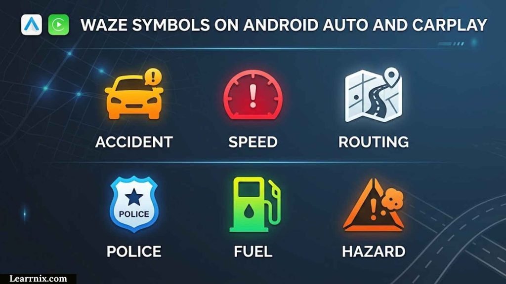
Waze can be used through in-car systems such as Android Auto and CarPlay.
However, some settings are managed from the phone.
Waze’s current help documentation instructs users who want to customize alerts for in-car use to make those changes on the phone. When using Android Auto or CarPlay, Waze may require the phone to be disconnected before changing certain settings.
This is useful if a driver notices that the in-car display does not provide the same settings as the phone application.
Waze Symbols and Driver Safety
The purpose of Waze symbols is to provide useful information without requiring drivers to read long explanations.
The safest approach is to use them as advance context.
If Waze reports a crash:
- Slow down when appropriate.
- Look for stopped traffic.
- Watch for emergency vehicles.
- Expect sudden lane changes.
If Waze reports construction:
- Watch for temporary signs.
- Expect lane shifts.
- Follow workers’ instructions.
If Waze reports a hazard:
- Increase your attention.
- Look for the actual hazard.
- Adjust speed when necessary.
The app should support your driving decisions, not replace your attention.
How to Learn Waze Symbols Quickly
You do not need to memorize every Waze icon.
Start with the categories that can directly affect your route.
Step 1: Learn Traffic Colors
Understand green, yellow, light red, red, and dark red.
Step 2: Learn Major Incident Symbols
Focus on:
- Crash
- Police
- Hazard
- Construction
- Closure
Step 3: Learn Safety-Related Road Reports
Then recognize:
- Blocked lane
- Car on shoulder
- Bad weather
Step 4: Learn Map Features
Add:
- Cameras
- Railroad crossings
- Traffic lights
- Road shields
Step 5: Learn Navigation and Community Icons
Finally, learn:
- Your car
- Destination
- Other Wazers
- Moods
This approach gives you the information that matters most without forcing you to memorize every visual detail.
Waze Symbols Cheat Sheet
| Symbol category | Meaning | Temporary or persistent? | What it tells you |
| Green road | Normal traffic | Changing | Traffic is moving relatively well |
| Yellow road | Light traffic | Changing | Some slowing |
| Light red road | Moderate traffic | Changing | Noticeable congestion |
| Red road | Heavy traffic | Changing | Significant delay likely |
| Dark red road | Near standstill | Changing | Severe congestion |
| Police | Police-related report | Usually temporary | Police activity was reported |
| Crash | Reported collision | Temporary | Accident reported |
| Hazard | Road danger | Temporary | Potential obstruction or danger |
| Construction | Roadwork | Temporary/variable | Construction activity |
| Camera | Mapped camera | Usually persistent | Camera location |
| Closure | Road closed | Temporary/variable | Road may be unavailable |
| Blocked lane | Lane obstruction | Temporary | Lane may be blocked |
| Car on shoulder | Stopped vehicle | Temporary | Vehicle reported on shoulder |
| Weather | Weather-related issue | Temporary/variable | Driving conditions may be affected |
| Railroad crossing | Railway crossing | Persistent | Physical crossing ahead |
| Traffic light | Mapped signal | Persistent | Traffic-control feature |
| Road shield | Route number | Persistent | Identifies road/highway |
| Car icon | Your vehicle | Trip-based | Your position |
| Destination marker | Destination | Trip-based | Where you are going |
| Wazer/mood | Other user | Changing | Community activity |
Waze Symbols: What to Check First
If you are looking at the map and want to understand an unfamiliar icon quickly, use this checklist:
- Is the road red? Check traffic.
- Is there a crash icon? Expect an incident or slowdown.
- Is there a police icon? A police-related report was submitted.
- Is there a hazard icon? Watch for an obstruction or dangerous condition.
- Is there construction? Expect temporary road changes.
- Is there a camera? Follow the posted traffic rules.
- Is there a closure? Expect a route change or unavailable road.
- Is there an X? It may identify a railroad crossing.
- Is there a small person or character? It may be another Wazer or mood.
- Is it your car icon? It represents your position.
- Is it a destination marker? It shows where you are headed.
- Is it a road shield? It identifies the route.
Frequently Asked Questions About Waze Symbols
What do the symbols on Waze mean?
Waze symbols communicate different types of information, including traffic conditions, crashes, police reports, hazards, construction, cameras, closures, road features, navigation information, and other Wazers.
What does the red road mean on Waze?
A red road indicates heavy traffic and significant congestion. Waze’s traffic visualization system uses darker red for more severe congestion, with dark red representing near-standstill traffic.
What does the yellow road mean on Waze?
Yellow indicates light traffic. It means traffic is slower than ideal but generally still moving.
What does the green road mean on Waze?
Green represents relatively normal traffic flow. Waze’s traffic documentation describes green as drivers moving at the speed limit.
What does the police symbol mean on Waze?
It represents a police-related report. Depending on location, Waze may provide more specific police-related categories such as mobile camera, hidden, or other-side reports.
What does the crash icon mean on Waze?
The crash icon indicates that a collision or accident has been reported. A crash can cause congestion, blocked lanes, emergency activity, or other road problems.
What does the hazard symbol mean on Waze?
A hazard symbol indicates a reported road danger or unusual condition. Examples can include obstructions, vehicles on the shoulder, blocked lanes, or weather-related hazards.
What does the camera symbol mean on Waze?
A camera symbol identifies a mapped camera. Waze currently supports camera categories including speed cameras, red-light cameras, speed-and-red-light cameras, stop-sign cameras, and mobile police cameras.
What does the X symbol mean on Waze?
An X-shaped symbol can represent a railroad crossing. Waze Community guidance specifically identifies these X-shaped symbols as railroad crossings.
What do the little people or characters mean on Waze?
They can represent other Waze users or their selected moods. Waze allows moods to be displayed to nearby Wazers.
What does my car icon mean on Waze?
The car icon represents your vehicle and current navigation position. Waze lets you choose a car icon under Settings → Map display → Car icon, and the selected car icon is visible only to you.
What does a road shield mean on Waze?
A road shield identifies a numbered route, highway, or other road designation. It is a navigation/map feature rather than an incident warning.
Why does Waze show a symbol that is no longer relevant?
Temporary reports can become outdated as road conditions change. Waze also changes which alerts it displays based on relevance and driver-distraction considerations.
Why doesn’t Waze show every report?
Waze intentionally limits and prioritizes alerts to reduce driver distraction. The company states that drivers may not receive alerts about everything on their route.
Can I turn off Waze symbols?
You can customize many alert categories through Settings → Alerts and reports → Reports. Depending on the alert, you can control whether it appears on the map and whether Waze alerts you while driving.
Can I hide Wazer icons?
Waze community guidance indicates that users can turn off the display of other Wazers through Map Display settings.
Why don’t I see the same Waze symbols as another person?
Symbols and alerts can vary by location, map data, settings, route relevance, and feature availability. Waze specifically notes that available alerts may vary by location.
Does Waze show traffic lights?
Waze can display mapped road features, including traffic lights where the relevant map data is available. The presence and appearance of map features can vary with map coverage and app behavior.
Are Waze symbols always accurate?
No. Temporary road reports can become outdated, and Waze may not know about an incident or camera that has not been reported through its available data sources. Waze specifically notes that it may not know about a camera if it has not been reported by an editor or partner.
Does a green road mean there are no hazards?
No. Green primarily describes traffic flow. A road can have normal traffic while still having a hazard, weather problem, road obstruction, or other safety issue.
Does a red road mean the road is closed?
No. Red generally represents heavy traffic. A road closure is a separate condition and may cause Waze to reroute you.
Why are Waze symbols different in different countries?
Waze features and alerts can vary by location. Local data, laws, reporting systems, map coverage, and feature availability can affect what users see.
Are Waze symbols the same on Android and iPhone?
The basic concepts are similar, but menus, interface details, and feature availability can differ between operating systems and app versions.
Are Waze symbols available on Android Auto and CarPlay?
Waze supports use with Android Auto and CarPlay, although some settings are managed from the phone rather than directly through the in-car interface. Waze recommends disconnecting the phone before changing certain alert settings.
Final Waze Symbols Checklist
Before you finish learning the Waze map, make sure you can distinguish:
- Traffic colors
- Police reports
- Crash reports
- Hazard reports
- Construction alerts
- Road closures
- Camera symbols
- Blocked-lane reports
- Car-on-shoulder alerts
- Weather alerts
- Railroad crossing symbols
- Traffic-light map features
- Road shields
- Your vehicle icon
- Destination marker
- Other Wazers
- Wazer moods
- Alert settings
The most important concept is not memorizing every icon. It is knowing which category an icon belongs to and what decision that information should help you make.
Key Takeaways About Waze Symbols
- Waze symbols are not all warnings. Some represent navigation, road features, cameras, or other Wazers.
- Traffic colors and incident icons communicate different information.
- Red generally means heavy traffic, not automatically a road closure.
- Police, crash, hazard, construction, and blocked-lane icons usually describe reported road conditions.
- Camera symbols identify mapped camera locations.
- An X-shaped symbol can identify a railroad crossing.
- Wazer moods represent the Waze community rather than road hazards.
- Your car icon represents your own vehicle and is visible only to you.
- Waze can limit and prioritize alerts to reduce driver distraction.
- Available alerts can vary by location.
- No symbol does not necessarily mean that no problem exists.
- Waze reports can become outdated as road conditions change.
- Real-world signs, signals, barriers, and safe driving decisions always take priority.
Conclusion
Understanding Waze symbols becomes much easier once you stop treating every icon as the same type of information.
The most useful approach is to divide the Waze map into four layers: incident reports, mapped road features, navigation markers, and community symbols. Traffic colors add another layer by showing how quickly vehicles are moving.
If you see a red road with a crash icon, for example, the red road tells you about congestion while the crash symbol tells you about the reported incident. If you see an X-shaped railroad symbol on a clear road, it is identifying a physical feature rather than reporting an accident. If you see a small character, it may simply be another Wazer or a user’s mood.
Waze also changes what it displays based on location, map data, route relevance, alert settings, and driver-distraction considerations. That is why two people may not always see exactly the same symbols.
The best way to use Waze is therefore not to memorize every icon. Learn the major categories, understand what each symbol is trying to communicate, and then compare that information with what you actually see on the road.

I am Michael Carter, an educational content creator who believes that knowledge has the power to transform lives.
I create resources focused on modern education, digital learning, and building essential skills for the future.
I love helping readers discover simple and effective ways to improve their learning journey.
Books by Michael Carter:
- Modern Education for Tomorrow’s World
- Learning Skills for Future Success
 Charlotte Anderson
 Daniel Harper